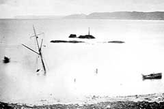
Dem moechte ich einen Abschnitt aus Mark Kurlanskys ausgezeichneten Buch "Cod, A Biography Of The Fish That Changed The World" hinzufuegen. Es geht dabei um die europaeische Kabeljaufischerei in amerikanischen Gewaessern im 17./18. Jhd.Knolle hat geschrieben: Berühmt wurde diese Katastrophe, weil sie symptomatisch für ein Problem steht, dass die Seefahrt jahrhundertelang unsicher machte: Es war seinerzeit unmöglich, den Längengrad eines Schiffes auf See zu bestimmen.
Mit anderen Worten, die ersten europaeischen Siedlungen in Kanada und Nordamerika lassen sich quasi 1:1 auf die entsprechenden Hafenstaedte in Europa abbilden, beispielsweise so:Mark Kurlansky hat geschrieben: The distinct destinies that would make the northern lands Canada's eastern provinces and the southern one the United States' New England states were established. [...] The ships would leave Europe in April, when there was a good easterly wind. Trans-Atlantic mariners wanted the wind dead on the stern, so they could run with it, sticking to the same latitude - a method called easting and westing. [...] Westing ships out of Bristol reached the Labrador coast and dropped down to Newfoundland. Bretons went straight to the Grand Bank and St. Johns. If a ship left the harbor at La Rochelle, dropping below the two islands that protect the harbor, and then stuck to its latitude, it would make a landfall at Cape Breton, where the French station of Louisbourg was established so that La Rochelle ships could easily find it.
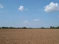
46 N, 0 (Frankreich):
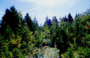
46 N, 60 W (Kanada):
(oder so aehnlich). Weitere nette Bilder moegen Sie selbst unter www.confluence.org
recherchieren.